ပန်းဆိုးတန်း-ဒလ ကူးတို့လမ်းနှင့် ဝါးတန်း-ဒလ ယာဉ်ကူးတို့လမ်းများ ခေါက်ရေတိုးချဲ့ပြေးဆွဲ
postdate
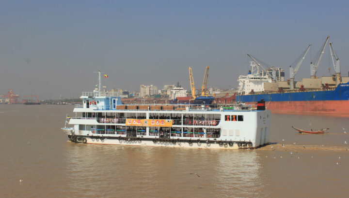
ပြည်တွင်းရေကြောင်းပို့ဆောင်ရေး၊ မြစ်ဝကျွန်းပေါ်ဌာနခွဲမှ ပြေးဆွဲပေးလျှက်ရှိသည့် ပန်းဆိုးတန်း-ဒလ ကူးတို့လမ်းတွင် "ချယ်ရီ-၁" ၊ "ချယ်ရီ-၂" နှင့် "ချယ်ရီ-၃" ရေယာဉ် (၃)စီးဖြင့် ရုံးဖွင့်ရက်များတွင် (၂၆)ခေါက်နှင့် ရုံးပိတ်ရက်များတွင် (၂၀)ခေါက် ပြေးဆွဲပေးလျက်ရှိခဲ့ရာမှ ယခုအခါ ခရီးသည်လိုက်ပါမှု အသင့်အတင့်များလာပါသဖြင့် (၂၁.၉.၂၀၂၁) ရက်နေ့မှစ၍ ရုံးဖွင့်ရက်များတွင် (၂၆)ခေါက်မှ (၃၀)ခေါက်သို့ ခေါက်ရေတိုးမြှင့် ပြေးဆွဲပေးလျက်ရှိပါသည်။
ပန်းဆိုးတန်း-ဒလ ကူးတို့လမ်းသွား ချယ်ရီရေယာဉ်
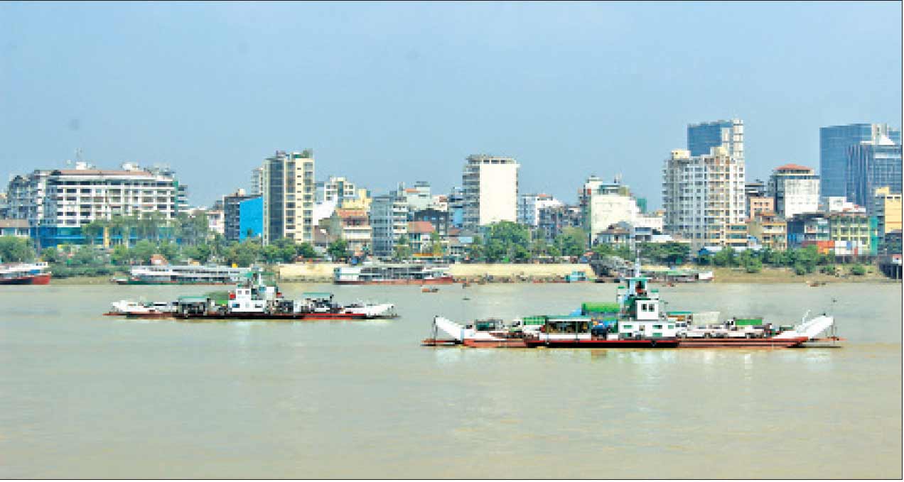
အလားတူ ဝါးတန်း-ဒလ ယာဉ်ကူးတို့လမ်းတွင် မော်တော်ယာဉ်များအား “ရိုရို-၂” ၊ “ရိုရို-၃” နှင့် “ရိုရို-၄” ဇက်ရေယာဉ် (၃) စီးဖြင့် တစ်နေ့လျှင် (၈)ခေါက်ပြေးဆွဲပေးလျှက်ရှိခဲ့ရာမှ (၂၁.၉.၂၀၂၁) ရက်နေ့မှစ၍ တစ်နေ့လျှင် (၉)ခေါက်သို့ ခေါက်ရေ တိုးမြှင့်ပြေးတွဲပေးလျှက်ရှိပါသည်။
ဝါးတန်း-ဒလ ယာဉ်ကူးတို့လမ်းသွား ရိုရိုရေယာဉ်များပုံ
ပန်းဆိုးတန်း-ဒလ ခရီးလမ်း ၂၁.၉.2021 ရက်နေ့မှစတင်၍ တနင်္လာနေ့မှသောကြာနေ့အထိ ရုံးဖွင့်ရက်များတွင် ပြေးဆွဲသည့် ရေယာဉ်ထွက်ချိန်စာရင်း | |||
စဉ် | ဒလဆိပ်ကမ်းမှ | ပန်းဆိုးတန်းဆိပ်ကမ်းမှ | မှတ်ချက် |
1 | 0530 | 0600 |
|
2 | 0600 | 0630 |
|
3 | 0630 | 0700 |
|
4 | 0700 | 0730 |
|
5 | 0730 | 0800 |
|
6 | 0800 | 0820 |
|
7 | 0820 | 0840 |
|
8 | 0840 | 0900 |
|
9 | 0900 | 0930 |
|
10 | 0930 | 1000 |
|
11 | 1000 | 1030 |
|
12 | 1030 | 1100 |
|
13 | 1100 | 1130 |
|
14 | 1130 | 1200 |
|
15 | 1200 | 1230 |
|
16 | 1230 | 1300 |
|
17 | 1300 | 1330 |
|
18 | 1330 | 1400 |
|
19 | 1400 | 1430 |
|
20 | 1430 | 1500 |
|
21 | 1500 | 1530 |
|
22 | 1530 | 1600 |
|
23 | 1600 | 1620 |
|
24 | 1620 | 1640 |
|
25 | 1640 | 1700 |
|
26 | 1700 | 1720 |
|
27 | 1720 | 1740 |
|
28 | 1740 | 1800 |
|
29 | 1800 | 1830 |
|
30 | 1830 | 1900 |
|
ပန်းဆိုးတန်း-ဒလ ခရီးလမ်း ၂၁.၉.2021ရက်နေ့မှစတင်၍ စနေနေ့မှ တနင်္ဂနွေနေ့ ရုံးပိတ်များတွင် ပြေးဆွဲမည့် ရေယာဉ်ထွက်ချိန်စာရင်း | |||
စဉ် | ဒလဆိပ်ကမ်းမှ | ပန်းဆိုးတန်းဆိပ်ကမ်းမှ | မှတ်ချက် |
1 | 0530 | 0600 |
|
2 | 0600 | 0630 |
|
3 | 0630 | 0700 |
|
4 | 0700 | 0730 |
|
5 | 0730 | 0800 |
|
6 | 0800 | 0830 |
|
7 | 0830 | 0900 |
|
8 | 0900 | 1000 |
|
9 | 1000 | 1100 |
|
10 | 1100 | 1200 |
|
11 | 1200 | 1300 |
|
12 | 1300 | 1400 |
|
13 | 1400 | 1500 |
|
14 | 1500 | 1600 |
|
15 | 1600 | 1630 |
|
16 | 1630 | 1700 |
|
17 | 1700 | 1730 |
|
18 | 1730 | 1800 |
|
19 | 1800 | 1830 |
|
20 | 1830 | 1900 |
|
ဝါးတန်း-ဒလ ဇက်ကူးတို့လမ်း ၂၁.၉.2021 ရက်နေ့မှစတင်၍ ပြေးဆွဲသည့် ရေယာဉ်ထွက်ချိန်စာရင်း | |||||
စဥ် | ဆိပ်ကမ်း | ထွက်ချိန် | ဆိပ်ကမ်း | ထွက်ချိန် |
|
1 | ဝါးတန်း | 08း00 | ဒလ | 07း00 |
|
2 | ဝါးတန်း | 10း00 | ဒလ | 09း00 |
|
3 | ဝါးတန်း | 12း00 | ဒလ | 11း00 |
|
4 | ဝါးတန်း | 14း00 | ဒလ | 13း00 |
|
5 | ဝါးတန်း | 15း00 | ဒလ | 15း00 |
|
6 | ဝါးတန်း | 15း30 | ဒလ | 16း00 |
|
7 | ဝါးတန်း | 16း30 | ဒလ | 17း00 |
|
8 | ဝါးတန်း | 17း30 | ဒလ | 18း00 |
|
9 | ဝါးတန်း | 18း30 | ဒလ | 19း00 |
|